 Geodata Germany v.22.03
Advertisement
Description
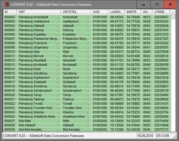
The database tables contains geodata of the Federal Republic of Germany with geo referenced towns, municipalities, town quarters and other administrative units, postal codes, telephone preselections, nature areas, landscapes, climatic zones and official topographical cartographies. The data contain coordinates for navigation and geo-coding, proximity searches and distance computations and are prepered for the spatial mapping of environmental...
Read more
- Rate:
- Release Date:08/01/2018
- License:Data Only
- Category:Database Solutions
- Developer:Killet Software Ing.-GbR
- Downloads:3530
- Size:3.06 Mb
- Price: $175.00
To free download a trial version of Geodata Germany, click here
To buy software Geodata Germany, click here
To visit developer homepage of Geodata Germany, click here
Advertisement
Versions History
| Version | Date Released | Release Notes |
| 18.01 | 23.05.2014 | Databases actualized on level 1st January 2014. Added datafield "Region Area Key" to databases ORTxxx. Snow and wind loads partially updated. New database REISEGEB with travel areas. Added center coordinates of counties in database KREIS. Added solar irradiation data to the database LASTEN. |
| 17.10 | 02.10.2013 | Town quarters, as well as snow and wind loads partially updated. Databases actualized on level 1st January 2013. New database REISEGEB with travel areas. Added center coordinates of counties in table KREIS. Added solar irradiation data to the database LASTEN. |
| 17.00 | 12.04.2013 | Databases actualized on level 1st January 2013. New database REISEGEB with travel areas. Added center coordinates of counties in table KREIS. Added solar irradiation data to the database LASTEN. Most likely postal codes added to telephon preselections. Database tables with Snow and Wind Load Zones. |
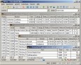
Screen Shot
Click on a thumbnail for the larger image.
System Requirements
Geodata Germany requires Win2000, WinXP, Win7 x32, Win7 x64, Windows 8, Windows 10, WinServer, WinOther, Windows2000, Windows2003, Windows Server 2012, Windows Tablet PC Edition 2005, Windows Media Center Edition 2005, WinVista, Windows Vista Starter, Windows Vista Home Basic, Windows Vista Home Premium, Windows Vista Business, Windows Vista Enterprise, Windows Vista Ultimate, WinVista x64, Windows Vista Home Basic x64, Windows Vista Home Premium x64, Windows Vista Business x64, Windows Vista Enterprise x64, Windows Vista Ultimate x64.
Geodata Germany v.22.03 Copyright
Shareware Junction periodically updates pricing and software information of Geodata Germany v.22.03 full version from the publisher using pad file and submit from users. Software piracy is theft, Using crack, password, serial numbers, registration codes, key generators, cd key, hacks is illegal and prevent future development of Geodata Germany v.22.03 Edition. Download links are directly from our publisher sites. Links Geodata Germany v.22.03 from Bittorrent, mediafire.com, uploadfiles.com, hotfiles.com rapidshare.com, megaupload.com, netload.in, storage.to, depositfiles.com and other files hosting are not allowed. The download file is obtained directly from the publisher, not from any Peer to Peer file sharing applications such as Shareaza, Limewire, Kazaa, Imesh, eDonkey, eMule, Ares, BearShare, Overnet, Morpheus, BitTorrent Azureus and WinMX.
Review This Software
More Geodata Germany Software
Advertisement

Geo Data Germany v.15.02
The database contain geodata of the Federal Republic of Germany with geo referenced towns, municipalities, town quarters, administrative units, postal codes, telephone preselections, nature areas, landscapes, climatic zones for proximity searches ec.

Germany Map Locator
Germany Flash Map Locator. Features: Driven by XML interface; - Color, URL linking, captions and more. And you can do all these; - Intuitive Flash Map Interface; - Ease of Use; - Customizations via an XML file, no Flash source modifications required; -
NFS Germany Flag Clock v.1 1
Germany Flag Clock screensaver features Germany flying flag and round clock displaying time on your monitor. The screensaver is for patriots of their country and fans of Germany.The clock numbers are Roman numerals ,
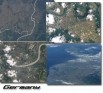
Earth from Space - Germany Screen Saver v.1.0
Protect your monitor with satellite-eye views of different parts of Germany.See pictures of Berlin, Munich, Cologne, Koblenz Area, Rhein River, Mosel River, Kiel, Frankfurt am Main, Wiesbaden, Mainz, Leipzig, Cottbus, Darmstadt, Duisburg, Hamburg,

German Pride app = Germany Pride - flwp7 v.1.0.0.0
German Pride app is a great app for Germany. It displays a German flag on your home screen as the tile.
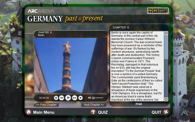
Past & Present: Germany v.1.0
Embark on a video journey through the rich culture and history of Germany!
Geodata International v.10.05
Geodata International - World-wide database of countries with georeferenced towns, municipalities, postal codes and administrative units with WGS84 and UTM coordinates and elevations for geocoding, proximity search, navigation, distance calculation.


Geodaten German Admin
The database contain geodata of the Federal Republic of Germany with geo referenced towns, municipalities, town quarters, administrative units, postal codes, telephone preselections, nature areas, landscapes, climatic zones. The data contain coordinates

Geo Data German Admin v.15.00
The database contain geodata of the Federal Republic of Germany with geo referenced towns, municipalities, town quarters, administrative units, postal codes, telephone preselections, nature areas, landscapes, climatic zones for proximity searches ec.
Geo Data German Admin (English) v.10 2
Geodata of the Federal Republic Germany with municipalities, postal codes, telefone preselections. Suitable for branch searches, periphery searches and distance computations. Georeferences as Gauss Krueger, UTM and geographic coordinates. ORTREF:
Other products of this developer Killet Software Ing.-GbR

DRAGSENS v.4.01
DRAGSENS Geo Software is used for the exact posi... estimation of the position of a dragged sensor.

Geodata International v.10.05
Geodata International - World-wide database of c...ximity search, navigation, distance calculation.

GeoDLL v.18.24
GeoDLL is a Geodetic Development Kit / Geodetic ...rt, NTv2, HARN, INSPIRE, EPSG, DEM and much more

Graphics4VO DLL v.11.04
Graphics4VO is the graphics interface for the pr... the display, printer, plotter, file and memory.

ORTWIN v.13.02
ORTWIN is a program for the inquiry of localitie...capes, natural units, snow- and wind load zones.

SEVENPAR v.8.01
SEVENPAR calculaties exact parameter sets for th...eference systems for coordinate transformations.

TOPOWIN v.16.00
TOPOWIN is a state-wide register of the German t...ms. It also is a topographic information system.

TRANSDAT v.20.37
TRANSDAT Coordinate Conversion supports thousand...le systems and much more with highest accuracy.